


no. 35: my favorite (off the beaten path) hikes
a list I have *never* shared before, plus top tips for hiking safely and a bonus surprise.


Same As it Ever Was, Claire Lombardo. When Julia runs into an old friend she hasn’t seen in years, the interaction and subsequent events sends her spiraling into reflections on her past even as she faces her family’s changing future. Lombardo also wrote one of my favorite reads in the past few years (The Most Fun We Ever Had) due in part to the incredible way she brings complex family dynamics to life, with emotions that feel palpable.
Dae Hair, Cactus Fruit 3-in-1 Styling Creme + Taming Wand: my postpartum baby hair regrowth is trying on the *best days* and downright harrowing on the worst. I’ve come to terms with it over the past year, but have *struggled* to find products to pull back my hair in a polished way that doesn’t leave me looking like a complete slimeball. So far this has worked quite well without being crunchy or greasy.
Hinge Health: I have had a few lingering issues that have flared up every so often over the past few years: a long standing weirdness with my hip after a marathon injury, some rotator cuff discomfort, and a desire to continue to restore my core and pelvic floor post-pregnancy. None of these things on their own felt like they were worth the hassle to seek out in-person physical therapy, but have been increasingly worrisome to just do nothing about. I finally checked out Hinge Health, a digital exercise therapy program. So far, I have been really impressed – the exercises are short (7-15 minutes) and the app is super easy to use. Unlike a lot of programs I’ve seen before, you’re matched with a local provider who oversees and customizes the program based on your feedback and progress. So far, it’s been engaging enough for me to be consistent, which is key!

heads up: this is a long one! if the email gets cut off, you may need to expand, view in browser or the substack app.

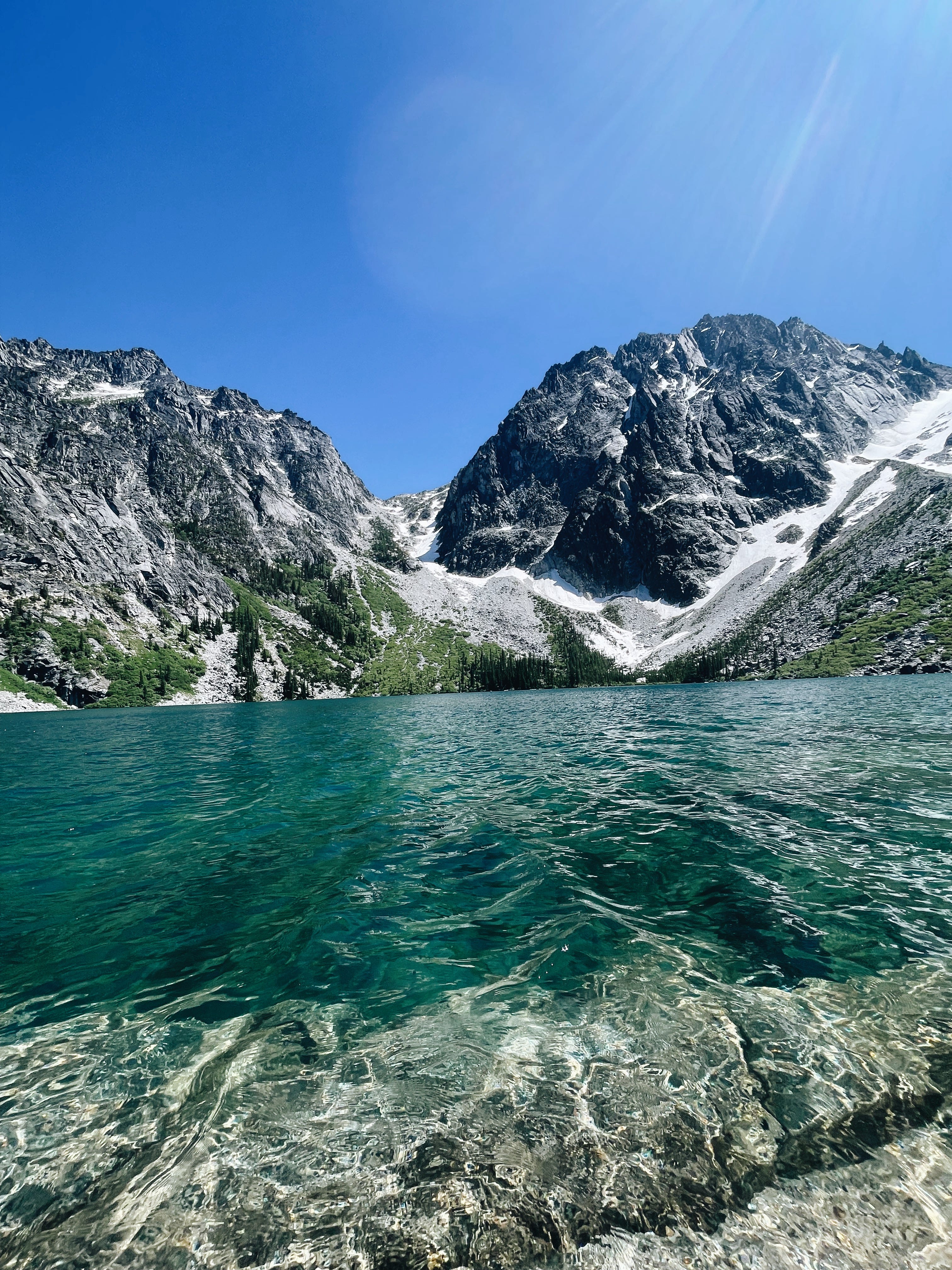
This winter, after years of attempts, I won the (literal) lottery.
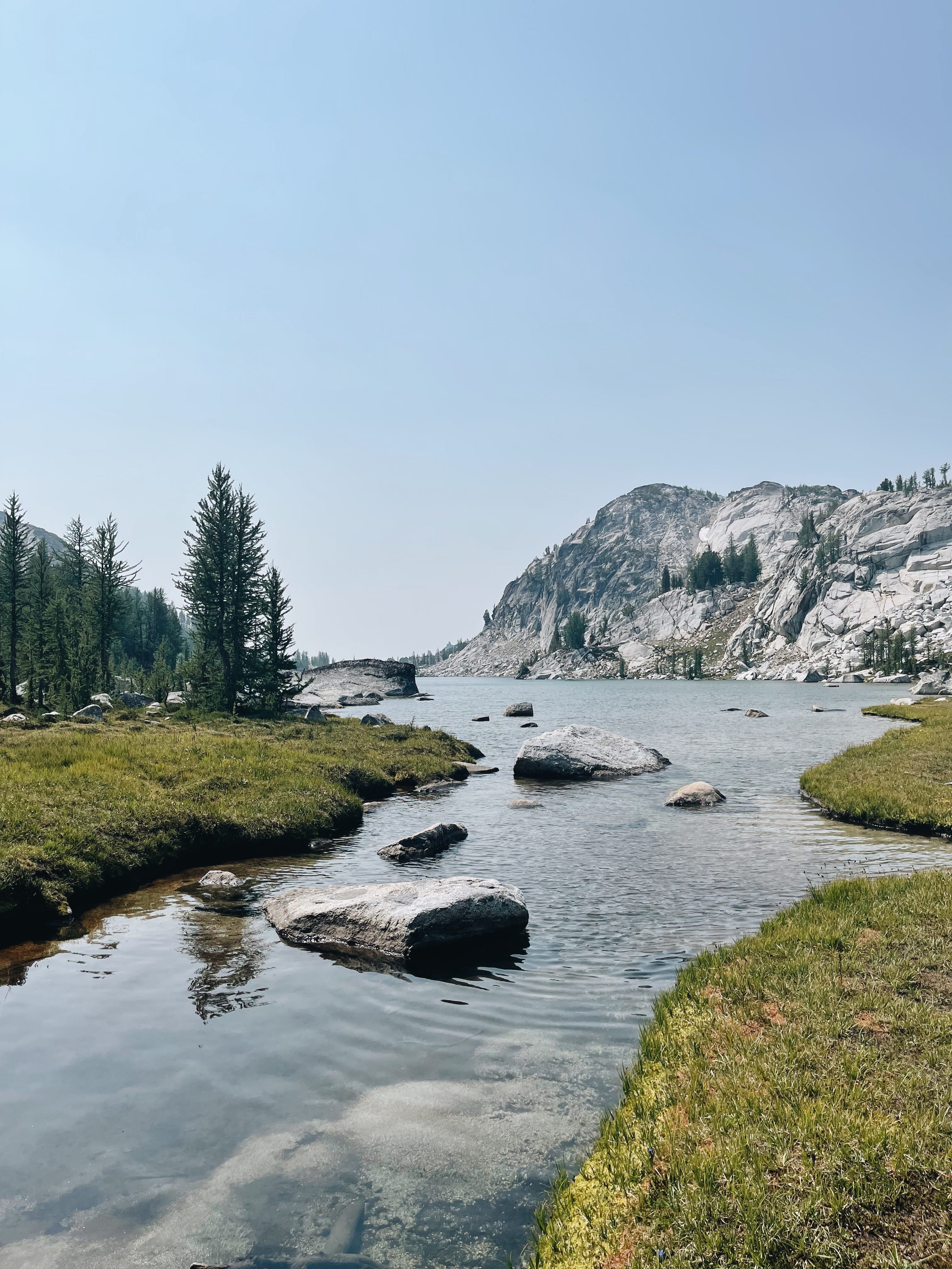
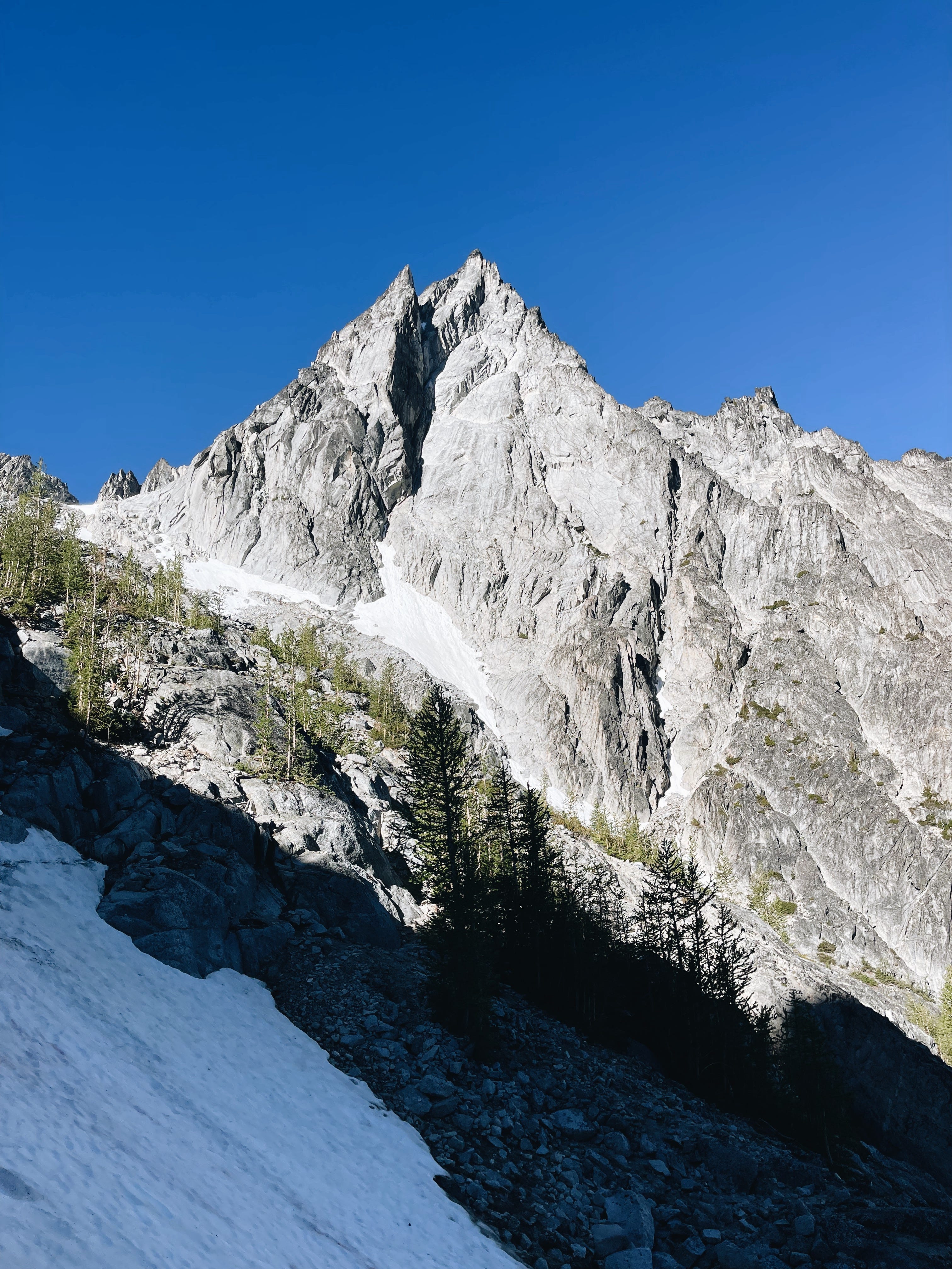
No, seriously. This year, out of over 40,000 applicants, I won one of the most competitive lotteries for backpacking permits in western Washington. The Enchantments, beloved for its stunning alpine lakes and meadows and striking mountain peaks, has become increasingly popular in recent years. Permits are notoriously hard to obtain, with lottery win rates that mirror acceptance rates at prestigious universities (around 4-8%). Just 24 people are allowed in the Core Enchantments Zone each night.
Part of the reason these permits are so in demand is that the most spectacular views are extremely remote – stunning lakes and varied terrains not accessible by car or even a casual hike – the trek to the first lake alone is 8 miles round trip. If you’re unable to get camping permits, the only way to see the “core zone” of the Enchantments is to do an in and out hike in one day with a day use permit (which is not currently limited). This notoriously difficult hike is +19 miles long, with over 4500 feet of elevation gain and 7000 feet of elevation loss. My experience on the through hike in 2021 remains one of the coolest and hardest things I have ever done (and I had an unmedicated childbirth).
Naturally, I was ecstatic to have the opportunity to return to The Enchantments this year for an annual Fourth of July backpacking trip we take with friends. Our weekday entry permit enabled us to take up to 8 people, and stay for up to 14 days in the Core and Colchuck Lake zones. We planned a three day, two night trip (day jobs, am I right) and I had planned to share a post about it as part mini travel blog, part “how in the heck did we do this with toddlers”.


But after being back home and reflecting on the experience, I feel extremely uneasy about it. On our trip this year, I was caught completely off guard by the overall number of day hikers, and worse, the number of hikers who did not seem prepared at all for the conditions they were in. On one of the hottest weekends of the year, we saw tons of people embarking on an 8+ mile hike with little to no water, hiking in jeans or wearing no sun protection. We saw folks traversing rocky terrain in rubber flip flops, leaving behind soda cans and chip wrappers. Multiple people had brought their dogs up the trail, despite a very severe risk of bear activity (and the high fines associated with having your dog there).
Even more concerningly was the number of unprepared who also didn’t know where they were going. Endless hikers were asking for directions to Aasgard Pass, the notoriously difficult entrance the the Core Enchantments that goes up nearly 2000 feet in elevation in just three quarters of a mile. Aasgard is extremely difficult to navigate, and can be incredibly dangerous: on my hike down with a friend, we saw hikers joking loudly that the path they were taking was “stupid” – followed almost immediately by one of them dislodging several large rocks from the unstable terrain and sending them showing down the mountain in an avalanche towards the hikers below.
I could go on, but I will simply say this: I am not clutching my pearls over the destruction of “untouched wilderness”. This concept is largely a myth that has been used to exclude and control, a fact that is highlighted by the debate over nature and wilderness as it relates to National Parks. Nothing brings me more joy than when I get messages from folks who were inspired to get out and hike for the first time from one of my posts.
But on the other hand, the permit lotteries exist for a reason; to protect an area from being loved to death. In many places like Mt. St. Helen’s, the permits apply to *anyone* entering the space, not only visitors who will be camping. I’ve read online that many people are starting to advocate for this system for day hikers in and around the Enchantments, and I have to say I agree.
This trip was a startling reminder to me of the importance of an inclusive outdoors community that equips new hikers with the knowledge that they need to be successful - for their own safety, the safety of others, and the safety of these beautiful spaces.
Inspiration to get outdoors is objectively a good thing. But it can’t be the only thing.
I have joked about how devastating it was to enter the Enchantments backpacking lottery unsuccessfully year after year, but the reality was that each year we have been disappointed, and each year we haven’t missed them, we just ended up filling our summer weekends with other incredible hikes or camping locations. Often, we are the only people for miles. Always, it is stunning.
And y’all I have been known to take things way too personally, and this is one of them. So today, we’ve got two big things:
My top tips & resources for getting started hiking, safely. Plus a surprise bonus!
My favorite Washington hikes that *aren’t* Colchuck Lake / the Enchantments
I love this one, and I hope you’ll take something from it!
Okay that’s it, love you!


TOP TIPS FOR HIKING, SAFELY:
Know, before you go: a lot of hikes (especially on the west coast) will be out of range for reliable service. It’s extremely important that you take steps to prepare *before you get to the trailhead* so you know where you’re going, and what to expect. Before you leave the house, I always recommend:
Use a tool like Washington Trails Association, and All Trails to research and choose a hike. You can filter by distance, the amount of elevation (how steep it will be), and difficulty, but you can also filter to choose hikes that are accessible, dog and kid-friendly, or have cool features like lakes, waterfalls, or seasonal wildflowers. You can also take a look at recent trail reports from other hikers to get a sense of what to expect when you are there. Folks often report on the quality of the trail (has it been maintained recently, or are there obstacles like downed trees?), condition of the trail (is it covered in snow? Really wet and muddy?) and their overall experience to help you prepare.
Once you pick a trail, don’t forget to review and download the trail map. You’ll want to have a sense of where you're going, and for how long. Is it an out and back trail, where you’ll need to stop and turn around? Is it a loop, where you won’t pass the same spot twice? Are there turn offs or markers you need to be aware of? Know before you head out!
Be prepared: The absolute most important thing you can do when bringing yourself and anyone you love out into the woods is to ensure that you are prepared and have what you need to get to and return from your destination safely. The Ten Essentials, a list to help people be prepared for unexpected situations in the wilderness is the place to start - from there, I always bring:
Sun protection: Not protecting yourself (or your little ones) from the sun is one of the most dangerous things you can do - it accelerates dehydration and can cause serious burns. Always bring hats, sunglasses, sunscreen, sun protective and UPF clothing.
Appropriate Clothing: Next most important? Dressing for the conditions, including strenuousness and weather. Choose shoes that will protect your feet, clothes that enable you to move easily and aren’t overly heavy (eg. I would avoid jeans) and always always bring additional layers. Hikes at higher elevations will have lower temperatures, and things can change quickly.
Extra water: Most people need about a half liter per hour during moderate activity in moderate temperatures - that’s per person, not including any children or pets you bring along. If you’re going into the backcountry or on longer hikes, recommend bringing a water filtration system so you can refill on the trail. (DO NOT DRINK UNFILTERED WATER).
Extra food: Listen y’all the best part of hiking is the snacks, and there is nothing worse than being hangry while walking uphill. Be smart and bring extra sustenance - high energy snacks like nuts, jerky, peanut butter, dried fruit. . (but please: pack out all your trash!)
First Aid: the pre-packed kits do well here. Speaking from experience the extra weight in a backpack is worth it even if you only ever need it once out of fifty something hikes.
Follow the rules of the road: There are some general best practices for hiking that can be helpful to know:
Trail traffic functions much like car traffic: stick to the right side of the trail for both upward and downhill.
Hikers going “up” have the right of way (that means if you’re headed down, step to the side or pause to allow them to pass)
When dogs are allowed, they should be leashed and you should actively supervise them to not lunge at other hikers, dogs, kids.
Be smart and have fun! You don’t know what you don’t know, but being smart about your own skills and limitations are really important when you're in the outdoors. Whether it’s deciding to turn around before you reach your intended destination because you aren’t feeling well, or choosing to slow down, stop, or retrace your steps if you feel a path your on is not stable or safe, you quite literally are better safe than sorry.
One example: we originally got Enchantments permits that would have allowed us to camp at either Colchuck Lake or within the Core Enchantments - but it would have meant that we had to take Baby Bear up an extremely dangerous, extremely unstable scramble. Mark and I are both very experienced, very practiced hikers who have done the hike in question before – and after a lot of reflection and checking the conditions, we decided that it wasn’t safe and changed our plans.
I have written about getting started in hiking and camping before, but had a partial paywall. As part of this issue, I’ve unlocked the entire post for any reader. It’s quite literally jam packed with all my tips and tricks, from the gear I recommend, the specific snacks I pack, how we hike and camp with a dog and a baby, and tons of expert resources.

MY FAVORITE HIKES IN WASHINGTON
(THAT AREN’T THE ONES YOU ALWAYS SEE RECOMMENDED)
This is probably just a Washington state problem, but I feel like a handful of hikes like the Enchantments have become social media darlings over the last few years (to their detriment). I have literally never done this, but with six years of research I’m happy to share some of my favorite hikes that are off the beaten path, to help you not only avoid the crowds of over hyped places but also see amaaaaaaazing views.
Here’s how the categories work:
Accessible: paved trails that meet ADA accessibility standards
Easy: trails that are both short in distance (>5 miles) and low in elevation gain (>1000 ft)
Moderate: trails that are longer distance (5-9 miles) and more elevation gain (1000-2000 ft) but not necessarily both
Difficult: trails that are long (8+ miles) AND have higher elevation gain (+2000 - 4000 ft).
As always: my assessment of the difficulty of these hikes represent facts (distance, duration, elevation) and my own experiences: please use the tips above to research, independently assess and prepare to enjoy your hikes safely.
Accessible:
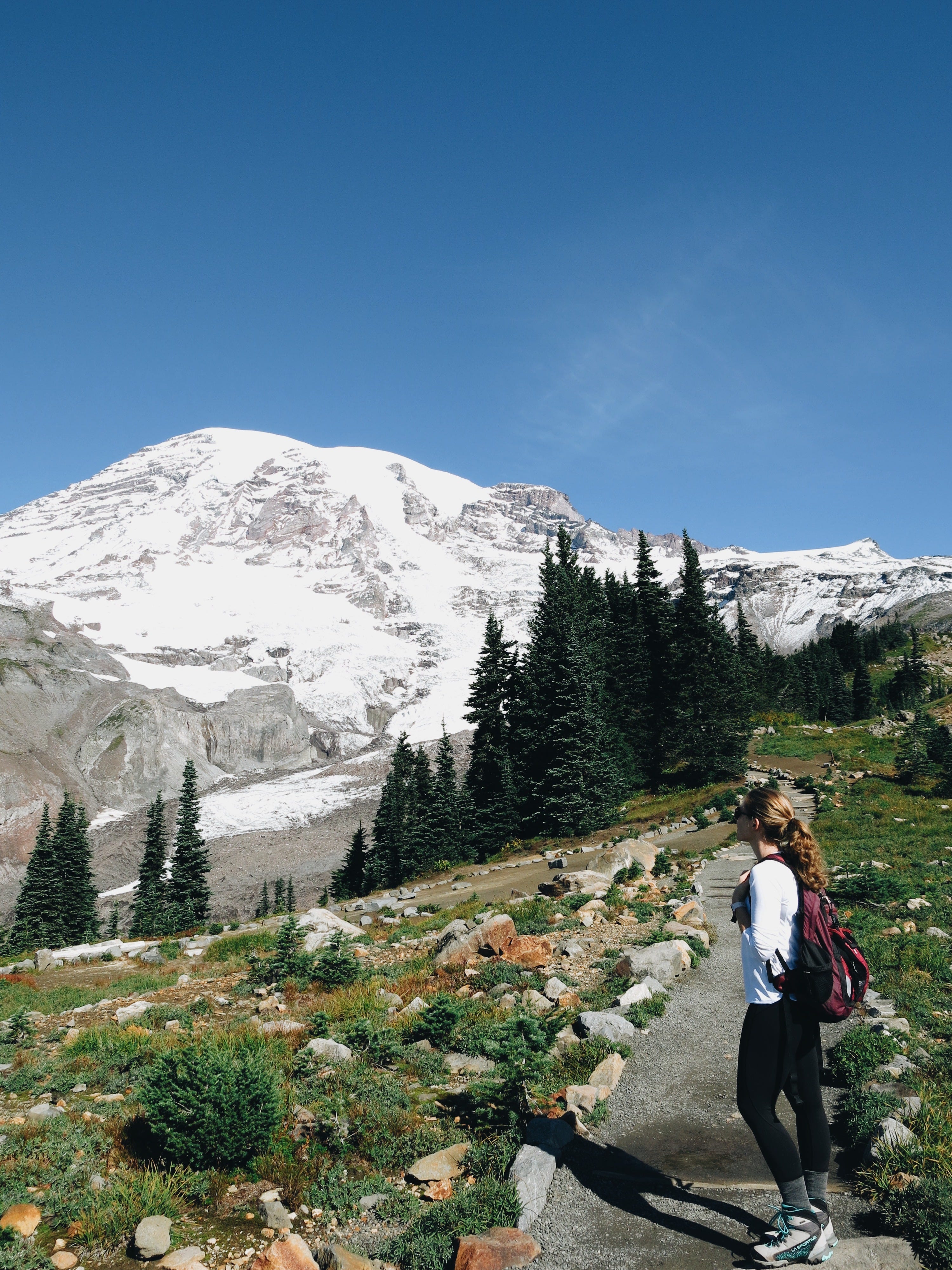
Myrtle Falls via Paradise Visitors Center at Mount Rainier National Park. This 0.8 Miles, 185 ft. elevation gain, fully paved trail is short but extremely scenic, with breathtaking views of Mount Rainier scattered with wildflowers and waterfalls. It is quite popular, so do recommend shoulder seasons or arriving on the early / late side.
In the North Cascades, Fire and Ice trail to Artist’s Point (0.5 miles, +100 ft elevation gain) has some absolutely stunning views, but do check the trail report – it’s packed in snow for a good amount of the year
Easy:


Hoping to avoid the big crowds at Rainier, or get big rewards with low commitment? Skip Paradise and head instead to Sunrise on the north side of the park to check out the Sunrise Nature trail, a 1.5 mile, 300 ft elevation gain, packed soil trail.


The San Juan Islands are some of the most beautiful favorite places in the state – we’ve gone camping there multiple times, and there are a ton of great hikes that you can do and not be too gross to also go eat lunch in town. A few faves: Cascade Lake in Moran State Park (Orcas Island) is a 2.7 mile, 300 ft elevation gain maintained trail (and you can rent boats to go out on the lake when you’re done!). Lime Kiln State Park (San Juan Island) is a 1.35 mile, 276 ft elevation gain packed soil hike overlooking the Puget Sound. The views are incredible, and it’s highly likely you’ll see whales.


Trying to get out to the coast? We loved Cape Disappointment State Park, with campsites right alongside the Pacific Ocean, and the Lewis and Clark Interpretive Center. You don’t have to go far at all for incredible views, HUGE waves, and really lovely beaches. It’s also a short way away from Astoria, Oregon, with some great food and coffee options.
What is your favorite non-overly popular hike, either in Seattle or in your area? Throw it in the comments with your location so I can round out these recommendations (and add to my own list!)
Moderate:


If you want a side of views with your hike, I love the Baker Lake - Maple Grove trail – it’s 8 miles and 500 ft of elevation gain round trip, but you can easily find a shorter turnaround - we usually stop to let Minnie swim at the Anderson Point campsites and then head back. The entire trail winds around a huge lake, with views of snow capped Mount Baker nearly the entire time.
If you’re looking for an Alpine Lake (that isn’t Colchuck or Snow Lake), I love Margaret Lake (6 miles, + 1800ft). The last time we did It, I think we only saw… four other people total? It was amazing.


Dying for big mountain views, and the quintessential PNW fire lookouts, but wanting to avoid the crowds around Rainier? I cannot express to you how incredible a hike Park Butte is, again in the Mount Baker area. There are alpine meadows, unobstructed, panoramic views of Mount Baker and the North Cascades, To make it all the way to the top of the fire lookout it’s 7.5 miles roundtrip and 2,200 ft of elevation gain, but there are some lovely lookout points along the way where you could turn off if you’d like to cut down on total distance and elevation.


Heading out to the Peninsula? I cannot say enough good things about the Little Quilcene Trail to Mt. Townsend – it’s a 6.8 mile, 2180 ft. elevation gain trail that pops you out on a ridge with panoramic views of the Cascades, Mount Baker, Puget Sound, and the Olympics. You can do distributed backpacking here – I highly recommend it. (and, if you want to be intense, you can head up to the same long ridge through a few different trails - Mt. Townsend is EXTREMELY HARD at 8 miles + 3000 ft but has even better views).
Difficult:


I feel like a handful of the hikes on the Seattle Side Snoqualmie Pass get all the hype - Mount Si, Mailbox Peak, Bandera Mountain, are all popular, well known difficult hikes. I personally prefer Granite Mountain, an 8.6 mile, +3,800 ft trek to a fire lookout that has everything – winding trails through the trees, ridgeline walks with views of Rainier, alpine meadows, and, of course, the fire lookout.


One of the most incredible hikes I’ve ever done: backpacked at Marmot Pass (11.5 miles, + 3,489) and hiked up to Buckhorn Mountain (+2.5 miles from Marmot, 13.5 miles and + 4477 feet from the trailhead) in the dark to watch the sunrise. Similar to Mt. Townsend, you can see the entire Puget Sound, Rainier, Mt. Baker, and both major mountain ranges. Goats abound, vibes are off the chart.


That is more than enough out of me, so I’ll leave it at that. Talk soon, love you!
I love this! My best friend works for the National Parks, and she has seen an increase in people who aren't prepared. I think it's great that you're sharing this in such a non-judgemental, helpful way. When I first started getting into the outdoors as an adult, I didn't always feel welcome. You're doing such great things for people enjoying Mother Nature!